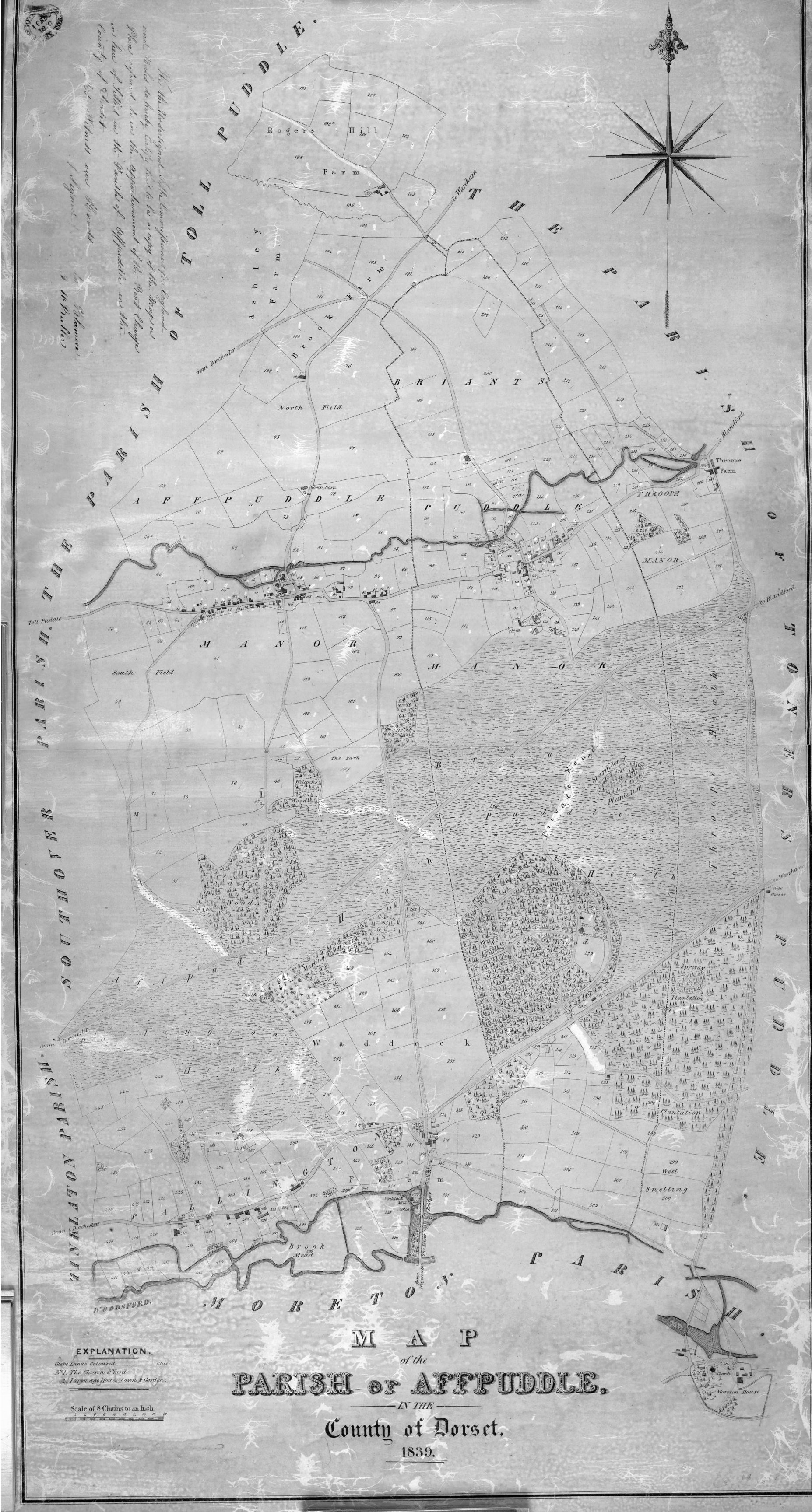
The 1839 Tithe map of the Parish of Affpuddle
Hover over the map to magnify.
Click on the map to open in a new window or tab in which you can click to open the map full size.
| # | Farm |
|---|---|
| 1 | Moreton House |
| 2 | Pallington |
| 3 | Waddock |
| 4 | Affpuddle West |
| 5 | Affpuddle East |
| 6 | Throop |
| 7 | Briantspuddle |
| 8 | Brook & Ashley |
| 9 | Rogers Hill |
- Moreton House is included in the Affpuddle map, but was actually in Moreton Parish, the seat of the owner of the parish lands, the Framptons. The three manors in the parish had been united during the lifetime of William Frampton when he bought Affpuddle Manor in 1675 and the remaining parts of Briantspuddle and Throop in 1682-3.
- Pallington farm – a very early enclosure, sold by the Frampton estate in 1953. (page 80-81).
- Waddock, Waddock Mill, Spyway, and Scutt’s Holding – also an enclosed farm from very early days. In the 1851 census Spyway was the home of the Frampton estate gamekeepers. The site of Waddock Mill is now the home of The Watercress Company.
- Affpuddle West and East were divided into two farms from the Manor of Affpuddle in 1828. Page two on this website is concerned with these two farms which were farmed by ancestors of mine in the 19th century.
- Throop was a small Manor going back in written history to 1553 but with little known history other than farmers in the 19th century. Briantspuddle, now the home of the Parish Council, has a history which can be read about at the Briantspuddle Community Website.
- Brook and Rogers Hill are separate farms in the 19th century. Part of Ashley lies outside the parish but its history is bound up with that of the parish.